-
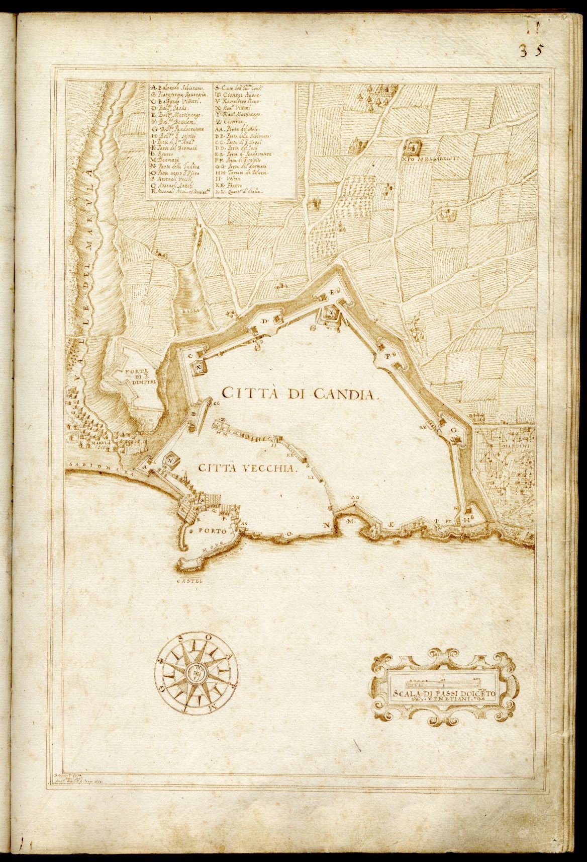
Historical maps of Candia
Developed at the Institute of Applied and Computational Mathematics, FORTH, Greece
Basilicata - Map of Candia
Developed at the Institute of Applied and Computational Mathematics, FORTH, Greece
Poulicos Prastacos, Dr. Civil Engineering, Director of Research, Institute of Applied and Computational Mathematics, Foundation of Research and Technology-Hellas, Poulicos@iacm.forth.gr. Profile
Eleni Gkadolou, Dr. Geography, postdoctoral researcher, Institute of Applied and Computational Mathematics, Foundation for Research and Technology – Hellas, elenigadolou@gmail.com.
Historical maps are cultural heritage assets of high aesthetic and historical scientific value that reflect the geographic literacy, the ideology, and the geo-political concerns of the historic period they were created. They provide the locations (places,topography etc.) that connect the geography of different cultural resources and can be used as base maps in digital applications. Historical maps, are also analytical tools for historical research, and in the framework of Digital Cultural Heritage and Digital Humanities, they should be described following a semantic approach that integrates data models, ontologies and standards.
The scope of this pilot project was twofold: a) extend previous research efforts on the use of CIDOC-CRM model, the standard tool for information integration in the field of cultural heritage, for modeling historical maps semantically, and b) demonstrate the validity of the proposed scheme for describing historical maps through the development of a pilot web application using the Arches platform for searching, visualizing, and managing historical maps.
The case study includes 17 historical maps of the island of Crete in Greece and of the city of Candia (current name Heraklion). The location of Crete in the East Mediterranean, in close proximity to South Europe, Turkey and Middle East is strategic; it has been a commercial center and through times various dominant powers occupied the island. Τhe geopolitical importance of the island has attracted many prominent cartographers and a long series of historical maps is available. The maps in the pilot application are from the 17th century, most of them created when Crete was under Venetian rulers. This is a small sample of the available maps and it is anticipated that the collection will be expanded in the near future.
Additional information is available at Gkadolou, E., Prastacos, P. (2021). Historical Cartographic Information for Cultural Heritage Applications in a Semantic Framework, CARTO; Volume: 56; Issue: 4, DOI: 10.3138/cart-2021-0002
In the Arches based application historical maps are described using seven different resource models. Attributes and relations link the various models. The definition of these conforms to the CIDOC-CRM model.
To retrieve historical maps users can apply thematic, temporal, and spatial criteria.
Thematic queries: Users can request a resource from the list of resources or using one or more keywords (e.g., map creator and material). The query can be on one or more of the resource models’ properties and the response is both the resource with its attributes and the relations defined. The search functionality is dynamic and retrieved information is visualized as overlays to the base map.
Temporal queries: Queries related to the time dimension associated with a particular resource can be made using either fields with temporal information and/or the time wheel provided by Arches on which users can select different time periods.
Spatial criteria: sers can search data using place names (modern or old) or geographic entities (types or names). They can also specify a geographic region (point, line, or polygon) on the base map or on the historical map and retrieve the resources inside the specified region and its relations as defined within the model.
Users can download the information for each map either as a report or as a graph.
This research was supported by the project: “METOPO: Mediterranean Landscapes of Culture: cultural landscapes of the past through time in the Mediterranean Sea” (MIS 5002532) implemented under the “Action for the Strategic Development on the Research and Technological Sector”, funded by the Operational Program "Competitiveness, Entrepreneurship and Innovation" (NSRF 2014-2020) and co-financed by Greece and the European Union (European Regional Development Fund). The authors would like to thank the Historical Museum of Crete for providing the digital maps of Candia and the Greek Literary and Historical Archive for providing the digital maps of Crete.